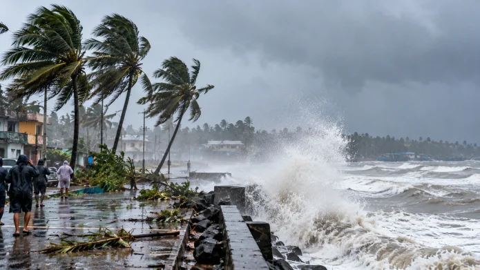
Cyclone Arnab has rapidly intensified into a Very Severe Cyclonic Storm and will make a direct landfall along the Andhra Pradesh and Yanam coasts on the forenoon of October 28, 2026. The India Meteorological Department issued a massive red alert for the region, warning local residents to prepare for sustained destructive winds reaching up to 125 km/h. Authorities across 16 districts have already mobilized disaster response teams and opened emergency shelters to prevent civilian casualties before the storm hits the beach.
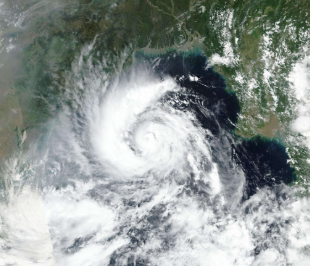
Exact Location and Timing of the Cyclone Arnab Landfall on October 28
Cyclone Arnab will officially cross the eastern Indian coastline between Bapatla and Visakhapatnam, passing very close to Yanam, just before noon on Wednesday, October 28. The India Meteorological Department (IMD) confirmed that maximum sustained wind speeds will range from 115 to 125 km/h, with sudden violent gusts peaking at 140 km/h.
This massive wind force carries enough power to uproot large trees, snap electrical poles, and destroy thatched homes entirely. The storm system currently sits over the Westcentral Bay of Bengal, moving steadily northwest toward the shore. Coastal residents must secure their physical property immediately and move to concrete structures well before the eye of the storm reaches the coastline.
South Central Railway Train Cancellations and Passenger Advisories
The South Central Railway (SCR) and South Eastern Railway completely canceled over 70 passenger and express trains scheduled to run between October 27 and October 29 to protect traveler safety. Railway Minister Ashwini Vaishnaw confirmed that over 600 kilometers of coastal rail track are currently under close physical watch by emergency engineering teams. Train routes running directly along the eastern coastal corridor face severe washout risks from flash flooding and debris blocking the tracks.
Major train cancellations include the Rourkela–Jagdalpur Express, Howrah-Jagdalpur Express, and the Secunderabad-Howrah Express. At least 11 major SCR trains were canceled entirely, while several others face partial route diversions.
If you hold a ticket for any train traveling through Andhra Pradesh or Odisha this week, you must assume your trip is suspended.
- Check digital statuses: Always check the official National Train Enquiry System (NTES) portal or application before leaving your house, as authorities continue to announce partial route changes hourly.
- Claim full refunds: The railway issues automatic refunds for fully canceled trains booked online, so do not travel to the physical station just to ask for your money back.
- Avoid road travel: Do not attempt to hire private taxis to bypass canceled trains, as local highways will experience severe waterlogging and uprooted trees.
Specific Regions Facing the Highest Risk of Storm Surges and Heavy Rain
The IMD predicts a highly dangerous storm surge measuring 1.0 to 2.0 meters above the normal astronomical tide, which will severely inundate low-lying coastal districts during the exact time of landfall. The absolute highest peak surge will hit the immediate coastal areas near Kakinada and Yanam. Sixteen districts across Andhra Pradesh currently sit on high alert, with additional police and disaster response forces actively deployed to Visakhapatnam and NTR districts.
Heavy to extremely heavy rainfall will trigger massive urban waterlogging and flash floods far beyond the immediate coastline. Ahead of the landfall, heavy rains already submerged roads in Odisha’s Puri and Bhubaneswar, severely affecting daily life and religious tourism. While Andhra Pradesh takes the direct hit, the storm bands will dump immense water across neighboring states over a 48-hour window.
| State or Region | Expected Weather Impact | Timeline for Heaviest Impact |
| Coastal Andhra Pradesh | Extremely heavy rain, 140 km/h wind gusts | October 27 – October 28 |
| South Odisha | Heavy to very heavy rain, 70 km/h wind gusts | October 27 – October 28 |
| East Uttar Pradesh | Heavy to very heavy rain | October 29 |
| Chhattisgarh & Telangana | Intense rainfall spells | October 28 – October 29 |
Emergency Safety Rules for Andhra Pradesh Coastal Residents
Local disaster management authorities officially banned all fishing operations across the Westcentral Bay of Bengal and ordered all commercial and private vessels to remain anchored until October 29. Entering the ocean right now is a guaranteed death sentence, as massive rogue waves dominate the coastal waters.
The National Disaster Management Authority (NDMA) advises all residents living in coastal hutments to relocate immediately to official concrete cyclone shelters. Do not wait for the rain to start before packing your emergency bag.
Follow these strict emergency fixes to survive the storm:
- Stockpile clean water: Fill every available bucket and bathtub in your house with clean water today, as local municipal water pumps will fail when the power grid goes down.
- Charge communication devices: Keep your mobile phones and portable power banks plugged in at 100 percent capacity until the storm makes landfall.
- Move valuables high: If you live on a ground floor near the coast, move your physical identification documents, electronics, and cash to the highest possible shelf to protect them from the 2-meter storm surge.
- Stay indoors: Do not step outside during the calm “eye” of the storm, as destructive winds will violently return from the opposite direction within minutes.
Residents can monitor live satellite updates through the Ministry of Earth Sciences portals to track the exact storm path. Always listen to local police and municipal workers; if they order an evacuation for your specific street, leave immediately without arguing.

